꾸러미:
com.skiracer.nautical_astore_mu
다운로드:
10
크기:
25 MB
지원되는 android 버전:
4.0 이상
업데이트 날짜:
2016년5월19일
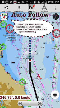
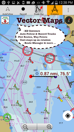
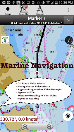

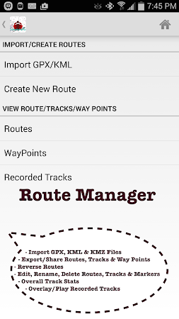
GPS Marine Charts App offers access to charts covering Seychelles Islands, Mauritius and Tanzania. First marine GPS app to have route assistance with Voice Prompts for marine navigation. You can create new boating routes or import existing GPX/KML routes. It supports Nautical Charts course up orientation. Includes Tide & Currents prediction. Features.
댓글