꾸러미:
nestides.noaa.hawaii
다운로드:
100
크기:
2 MB
지원되는 android 버전:
2.3 이상
업데이트 날짜:
2015년5월6일
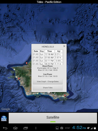
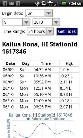
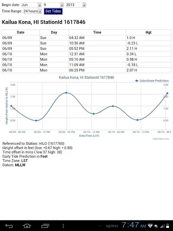
Accurate, simple to use Satellite Map based LIVE NOAA Hawaii tide chart data for the entire Hawaiian coastline on a simple to use satellite map. Simple to use, no spam ads. 100% ad free. East to Use, advanced tide graphs allow for you to judge the level of water movement for optimal surfing, boating or fishing between high and low tide.
댓글